The Bosporus and Dardanelles straits are two of the most significant waterways in the world, connecting the Black Sea to the Aegean Sea and ultimately to the Mediterranean. A map of the Bosporus and Dardanelles helps us understand their critical geographical placement, maritime importance, and role in global trade and military strategy. These straits are not only vital for shipping routes but also play a key part in Turkey’s national identity, history, and international diplomacy. Through maps and spatial understanding, one can grasp how these straits influence navigation, politics, and the environment in the surrounding region.
Geographical Location of the Straits
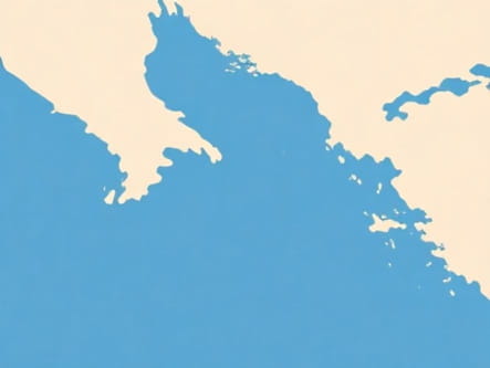
The Bosporus Strait
The Bosporus is a narrow, natural strait that separates the European part of Turkey from its Asian counterpart. It runs approximately 30 kilometers in length and varies between 700 meters and 3.7 kilometers in width. On a map, the Bosporus appears as a thin blue line running vertically through the city of Istanbul. This strategic waterway links the Black Sea to the Sea of Marmara, forming part of the continental boundary between Europe and Asia. The city of Istanbul straddles both sides, making it one of the few cities in the world to span two continents.
The Dardanelles Strait
The Dardanelles, also known as the Hellespont in ancient times, lies to the southwest of the Bosporus. It connects the Aegean Sea with the Sea of Marmara and is about 61 kilometers long. The strait ranges from 1.2 to 6 kilometers in width and is deeper and more navigable than the Bosporus. On a detailed map, the Dardanelles is clearly seen running northwest to southeast, bordered by the Gallipoli Peninsula to the northwest and the mainland of Anatolia to the southeast. It is entirely within Turkish territory and plays a vital role in the country’s maritime domain.
Physical Features on the Map
Waterway Connectivity
When looking at a map of the Bosporus and Dardanelles, one of the most important observations is how these straits connect several major bodies of water
- Black Sea → Bosporus → Sea of Marmara → Dardanelles → Aegean Sea → Mediterranean Sea
This chain of connection illustrates the global maritime significance of the Turkish Straits. Control over these waterways provides Turkey with a unique advantage in regulating access to the Black Sea, especially for countries such as Russia, Ukraine, and Bulgaria.
Surrounding Landmarks and Cities
On maps, Istanbul dominates the Bosporus region. The city’s famous bridges the Bosphorus Bridge, Fatih Sultan Mehmet Bridge, and Yavuz Sultan Selim Bridge are typically marked as major transport links. In the Dardanelles area, the key towns of Çanakkale and Eceabat are visible. The Gallipoli Peninsula is also highlighted on most maps, especially because of its historical importance during World War I. Nearby islands like Imbros (Gökçeada) and Tenedos (Bozcaada) appear near the entrance to the Dardanelles from the Aegean Sea.
Historical Importance
Strategic and Military Relevance
Maps of the Bosporus and Dardanelles are often used to illustrate key historical events. During the Byzantine and Ottoman periods, these straits were essential for defense and trade. The Dardanelles played a critical role in the Gallipoli Campaign of World War I, and maps from that time highlight trench positions, naval routes, and troop landings. The strategic value of controlling these straits cannot be overstated, as they serve as the only maritime outlet for several landlocked countries around the Black Sea.
International Agreements
Modern maps are sometimes annotated with treaty zones and navigation limits due to agreements like the Montreux Convention of 1936. This treaty gives Turkey control over the Bosporus and Dardanelles while guaranteeing free passage for civilian vessels during peacetime. The convention has strategic implications that are visible on geopolitical maps showing naval movements, security boundaries, and exclusive economic zones.
Economic and Commercial Relevance
Shipping Routes
The map of this region is filled with maritime traffic lines, as both the Bosporus and Dardanelles are heavily used for global shipping. Crude oil, natural gas, agricultural products, and manufactured goods are transported through these straits. Approximately 40,000 ships pass through the Bosporus annually, making it one of the busiest waterways in the world. Ports such as Istanbul, Tekirdağ, and Bandırma are marked on shipping maps, along with the anchorage points and vessel traffic separation schemes that regulate passage.
Energy Pipelines and Infrastructure
In addition to sea traffic, the map may also show energy corridors that run near or through this region. Pipelines like the Baku-Tbilisi-Ceyhan pipeline and various gas routes across Turkey highlight how the straits are part of a broader energy network. Infrastructure such as the Marmaray Tunnel under the Bosporus is also visible on many modern transit maps, showing how the region supports both sea and land transport.
Environmental and Navigational Challenges
Hazards in the Bosporus
Despite its beauty, the Bosporus poses significant navigational risks. Maps often include detailed markings of sharp turns, narrow passages, and strong currents. Ships navigating this strait must follow strict protocols due to limited visibility and high vessel density. Navigation charts include buoys, lighthouses, and traffic control zones.
Ecological Concerns
Environmental maps of the Bosporus and Dardanelles may show sensitive marine habitats and protected zones. Oil spills, ballast water discharge, and industrial pollution have affected water quality and marine biodiversity. Efforts to clean and protect the straits are ongoing, and maps are tools for monitoring ecological health in this high-traffic zone.
Modern Mapping Technologies
Satellite and GIS Mapping
Satellite maps and GIS (Geographic Information System) tools provide highly detailed images of the Bosporus and Dardanelles. These allow for real-time monitoring of ship movements, weather patterns, and land development. GIS data also helps in disaster planning, such as preparing for earthquakes or oil spills, which are relevant in this seismically active region.
Navigation Apps and Marine Charts
For commercial and recreational navigation, marine charts are essential. These charts show depth contours, port facilities, and traffic rules. Digital navigation tools, including AIS (Automatic Identification Systems), rely on precise mapping of the straits for safety and logistics. Apps used by mariners display live data for approaching, anchoring, and passing through these complex waterways.
The Bosporus and Dardanelles straits are far more than simple geographic features they are dynamic corridors that connect continents, economies, and cultures. A detailed map of the Bosporus and Dardanelles reveals their true significance, from maritime logistics and energy transport to historical conflicts and modern geopolitics. Understanding their geography through maps offers insight into how Turkey’s position at this crossroads continues to influence the global stage. As global trade increases and regional dynamics evolve, these strategic waterways will remain at the center of attention for policymakers, merchants, and travelers alike.