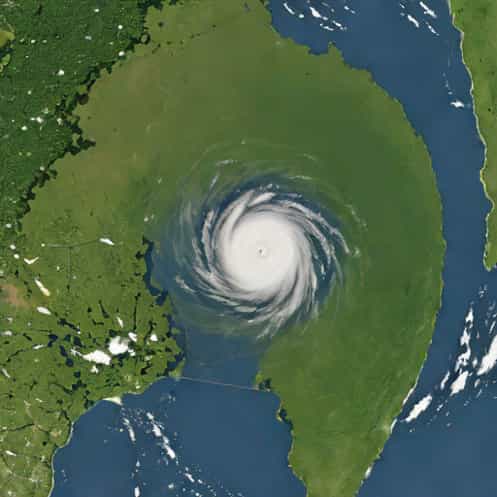
Hurricane Katrina, one of the most devastating storms in United States history, is widely studied for its rapid intensification over the Gulf of Mexico. Rapid intensification refers to a sudden and significant increase in a hurricane’s strength, often measured by a dramatic rise in wind speeds and drop in central pressure within a short period of time. Katrina’s rapid intensification not only caught many people off guard but also highlighted the challenges meteorologists face in predicting extreme tropical cyclones. Understanding the factors that contributed to Katrina’s sudden strengthening is crucial for improving hurricane forecasting and minimizing future loss of life and property.
What is Rapid Intensification?
Rapid intensification occurs when a tropical cyclone’s maximum sustained winds increase by at least 30 knots within 24 hours. This phenomenon is influenced by several environmental factors, including warm sea surface temperatures, low vertical wind shear, high moisture content in the atmosphere, and favorable oceanic heat content. Hurricanes that undergo rapid intensification can reach catastrophic strength within a day, making preparedness and evacuation more difficult for affected populations. Katrina is a classic case of rapid intensification, showing how quickly a storm can escalate from a tropical storm to a Category 5 hurricane under the right conditions.
The Development of Hurricane Katrina
Hurricane Katrina originated as a tropical depression over the southeastern Bahamas on August 23, 2005. Initially, the storm moved slowly, gradually strengthening into a tropical storm and then a Category 1 hurricane. For several days, Katrina’s intensity fluctuated due to interactions with land and varying atmospheric conditions. However, once it entered the warm waters of the Gulf of Mexico, the storm underwent a remarkable transformation. Within approximately 24 hours, Katrina’s central pressure dropped dramatically, and wind speeds increased, marking a period of rapid intensification that allowed it to reach Category 5 strength at its peak.
Factors Contributing to Katrina’s Rapid Intensification
Several environmental and oceanic conditions contributed to the rapid intensification of Hurricane Katrina. Key factors include
- Warm Sea Surface TemperaturesThe Gulf of Mexico had unusually warm waters in August 2005, providing abundant heat energy to fuel the storm.
- High Ocean Heat ContentBeyond surface temperatures, deep layers of warm water allowed Katrina to maintain its energy without weakening due to cooler waters below.
- Low Vertical Wind ShearMinimal changes in wind speed and direction with height allowed the storm’s structure to remain intact and strengthen efficiently.
- Moist AtmosphereHigh humidity in the mid and lower atmosphere prevented dry air intrusion, which can often weaken hurricanes.
These conditions combined to create an environment highly conducive to rapid intensification, allowing Katrina to gain strength far faster than normal, ultimately contributing to its catastrophic impact along the Gulf Coast.
Impacts of Rapid Intensification on Forecasting
Katrina’s rapid intensification posed significant challenges for meteorologists. Forecast models at the time struggled to predict the sudden surge in intensity accurately, leading to underestimation of the storm’s potential impact. Emergency management and local authorities had limited time to prepare, resulting in delayed evacuations and increased vulnerability for residents along the Louisiana and Mississippi coasts. Rapid intensification events like Katrina demonstrate the importance of improving forecasting tools, monitoring systems, and predictive models to provide timely warnings for affected communities.
Case Studies and Lessons Learned
Researchers have extensively studied Hurricane Katrina to understand the dynamics of rapid intensification. These studies have highlighted several lessons
- Even small changes in sea surface temperatures or atmospheric conditions can trigger rapid strengthening.
- Continuous satellite and ocean monitoring is essential to detect signs of intensification early.
- Improved computer models that account for ocean-atmosphere interactions can enhance prediction accuracy.
- Rapid intensification underscores the need for proactive evacuation planning and public awareness campaigns, especially in hurricane-prone regions.
By analyzing Katrina, meteorologists gained valuable insights into the mechanisms of hurricane intensification, helping refine warning systems and emergency response strategies for future storms.
Global Significance of Understanding Rapid Intensification
Hurricane Katrina serves as a cautionary tale for coastal communities worldwide. Rapid intensification is not unique to the Gulf of Mexico; it can occur in any tropical cyclone-prone region, including the Atlantic, Pacific, and Indian Oceans. Understanding the conditions that trigger rapid intensification is critical for global hurricane preparedness. Increased knowledge can inform building codes, infrastructure planning, and disaster management strategies, reducing the human and economic toll of extreme storms.
Technological Advances in Monitoring and Prediction
Since Katrina, significant progress has been made in hurricane monitoring and forecasting. Satellite imagery, ocean buoys, and aircraft reconnaissance provide real-time data on storm intensity, sea surface temperatures, and atmospheric conditions. Advanced numerical models now better simulate the complex interactions between ocean and atmosphere that lead to rapid intensification. These technological advancements aim to give communities more lead time, improving evacuation efficiency and overall disaster preparedness.
Hurricane Katrina’s rapid intensification stands as one of the most studied meteorological events in recent history. The sudden increase in intensity showcased how powerful environmental and oceanic factors can converge to amplify a tropical cyclone in a short period. By examining the conditions that contributed to Katrina’s strengthening, scientists have enhanced their understanding of rapid intensification and improved forecasting methods. The lessons learned from Katrina remain vital for protecting lives and property in hurricane-prone regions, emphasizing the need for continuous monitoring, robust emergency planning, and public awareness. Understanding rapid intensification is not just a scientific pursuit it is a critical step in mitigating the devastating effects of extreme weather events worldwide.